AGRIVI, the most comprehensive Farm Management Software on the market, is launching a new state-of-the-art feature focused on a seamless field-centric visual experience.
Field Operations (Field Ops) is a powerful new module within the AGRIVI platform, the first being developed through the AGRIVI tech 3.0 stack including brand new frontend technologies.
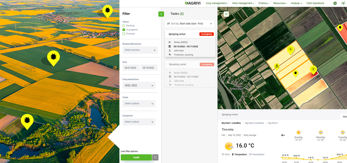
It provides a deeply integrated overview of all your farm’s fields, crop types, crop productions, tasks, and operations, displayed through an easy-to-use map-based, field-centric visual interface.
With Field Ops, AGRIVI now offers an enhanced immersive experience relying on several layers of insights visualization, from satellite-based agronomic vegetation indices (9 of them) to comprehensive micro-locations weather data, providing immediate value to each user.
The Field Ops interface combines relevant information on current and planned operations within the same map, insightful scouting records, and actionable insights which will help any farmer to take timely data-driven decisions and therefore contributes to the successful digitalization of farm operations through higher adoption rates. This feature also reduces the time spent using the app.
With Field Operations we have created a brand-new experience of farm management that is intuitive, seamless, and field-centric. Operations and scouting records visualization as well as satellite imagery and agronomic insights will empower farmers to take the right management decisions, remotely, and to eventually save time and money, said Guillaume Antoine Rabhi, Chief Digital Officer at AGRIVI.
Field Ops is currently available to all AGRIVI users, and additional features will be continuously deployed in the new module.